Allegany County, Maryland
| Allegany County, Maryland | ||
|
||
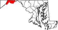 Location in the state of Maryland |
||
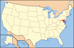 Maryland's location in the U.S. |
||
| Founded | 1789 | |
|---|---|---|
| Named for | A local Native American word, oolikhanna, which means "beautiful stream." | |
| Seat | Cumberland | |
| Largest city | Cumberland | |
| Area - Total - Land - Water |
430 sq mi (1,114 km²) 425 sq mi (1,101 km²) 4 sq mi (10 km²), 1.02% |
|
| PopulationEst. - (2005) - Density |
73,639 176/sq mi (68/km²) |
|
| Website | gov.allconet.org | |

Allegany County is a county located in the northwestern part of the U.S. state of Maryland. It is part of the Cumberland, MD-WV Metropolitan Statistical Area. As of 2000, the population was 74,930. Its county seat is Cumberland. The name Allegany comes from a local Native American word, oolikhanna, which means "beautiful stream." A number of counties in the Appalachian region of the United States are named Allegany, Allegheny or Alleghany.
Contents |
History
The western part of Maryland (including the present Allegany County) was incorporated into Prince George's County in 1696. This county included six current counties, and by repeated splitting, new ones were generated: Frederick from Prince George's in 1748; and Montgomery and Washington from Frederick in 1776.[1]
Allegany County was formed in 1789 by the splitting of Washington County. At the time it was the westernmost county in Maryland, but a later (1872) split produced Garrett County, the current westernmost county.
The county has a number of properties on the National Register of Historic Places.[1]
Law and government
Allegany County was granted a home rule form of government in 1974.
Transportation
- Allegany County Transit
- Amtrak
- Western Maryland Scenic Railway
Geography
According to the U.S. Census Bureau, the county has a total area of 430 square miles (1,113 km²), of which, 425 square miles (1,102 km²) of it is land and 4 square miles (11 km²) of it (1.02%) is water.
Adjacent counties
- Somerset County, Pennsylvania (northwest)
- Bedford County, Pennsylvania (north)
- Fulton County, Pennsylvania (northeast)
- Washington County (east)
- Morgan County, West Virginia (southeast)
- Hampshire County, West Virginia (south)
- Mineral County, West Virginia (southwest)
- Garrett County (west)
 |
Somerset County, Pennsylvania | Bedford County, Pennsylvania | Fulton County, Pennsylvania | |
| Garrett County | Washington County | |||
| Mineral County, West Virginia | Hampshire County, West Virginia | Morgan County, West Virginia |
National protected areas
- Chesapeake and Ohio Canal National Historical Park (part)
Significant Topographic Features
- Evitts Mountain
- Dans Mountain
- Polish Mountain
- Town Hill
- Haystack Mountain
- Martin Mountain
- Wills Mountain
- Piney Mountain
- Green Ridge Mountain
Major highways
 Interstate 68
 U.S. Route 40
US 40 Alt
U.S. Route 40 Scenic U.S. Route 220
 Maryland Route 35
 Maryland Route 36
 Maryland Route 47
 Maryland Route 49
 Maryland Route 51
 Maryland Route 53
 Maryland Route 55
 Maryland Route 135
 Maryland Route 144
 Maryland Route 638
 Maryland Route 657
 Maryland Route 658
 Maryland Route 935
 Maryland Route 936
 Maryland Route 956
Demographics
| Historical populations | |||
|---|---|---|---|
| Census | Pop. | %± | |
| 1830 | 10,590 |
|
|
| 1850 | 22,799 |
|
|
| 1900 | 53,694 |
|
|
| 1910 | 62,411 | 16.2% | |
| 1920 | 69,938 | 12.1% | |
| 1930 | 79,098 | 13.1% | |
| 1940 | 86,973 | 10.0% | |
| 1950 | 89,556 | 3.0% | |
| 1960 | 84,169 | −6.0% | |
| 1970 | 84,044 | −0.1% | |
| 1980 | 80,548 | −4.2% | |
| 1990 | 74,946 | −7.0% | |
| 2000 | 74,930 | 0% | |
As of the census[2] of 2000, there were 74,930 people, 29,322 households, and 18,883 families residing in the county. The population density was 176 people per square mile (68/km²). There were 32,984 housing units at an average density of 78 per square mile (30/km²). The racial makeup of the county was 93.02% White, 5.35% Black or African American, 0.15% Native American, 0.52% Asian, 0.03% Pacific Islander, 0.19% from other races, and 0.75% from two or more races. 0.76% of the population were Hispanic or Latino of any race. 29.0% were of German, 16.7% United States or American, 12.8% Irish, 10.7% English and 5.3% Italian ancestry according to Census 2000.
There were 29,322 households out of which 26.50% had children under the age of 18 living with them, 50.60% were married couples living together, 10.30% had a female householder with no husband present, and 35.60% were non-families. 30.10% of all households were made up of individuals and 15.20% had someone living alone who was 65 years of age or older. The average household size was 2.35 and the average family size was 2.90.
In the county the population was spread out with 20.60% under the age of 18, 11.20% from 18 to 24, 26.80% from 25 to 44, 23.50% from 45 to 64, and 17.90% who were 65 years of age or older. The median age was 39 years. For every 100 females there were 99.20 males. For every 100 females age 18 and over, there were 96.90 males.
The median income for a household in the county was $30,821, and the median income for a family was $39,886. Males had a median income of $31,316 versus $21,334 for females. The per capita income for the county was $16,780. About 9.70% of families and 14.80% of the population were below the poverty line, including 17.70% of those under age 18 and 9.50% of those age 65 or over.
Cities and towns
This county contains the following incorporated municipalities:
- 2 Cities:
- Cumberland (incorporated 1815)
- Frostburg (incorporated 1839)
- 5 Towns:
- Barton (incorporated 1900)
- Lonaconing (incorporated 1890)
- Luke (incorporated 1922)
- Midland (incorporated 1900)
- Westernport (incorporated 1858)
In Total: 7
Occupying a middle ground between incorporated and unincorporated areas are Special Tax Districts, quasi-municipal unincorporated areas created by legislation passed by the Maryland General Assembly.[2] They lack home rule authority and must petition the General Assembly for changes affecting the authority of the district. There are eight Special Tax Districts in the county:
- Bel Air (1965)
- Bowling Green and Robert's Place (1972)
- Cresaptown (1949)
- Ellerslie (1963)
- La Vale Sanitary District (1947)
- McCoole (1965)
- Mount Savage (1950)
- Potomac Park Addition (1947)
Unincorporated areas are also considered as towns by many people and listed in many collections of towns, but they lack local government. Various organizations, such as the United States Census Bureau, the United States Postal Service, and local chambers of commerce, define the communities they wish to recognize differently, and since they are not incorporated, their boundaries have no official status outside the organizations in question. The Census Bureau recognizes the following census-designated places in the county:
- Cresaptown-Bel Air (a combination of the communities of Cresaptown and Bel Air recognized as a unit by the Census Bureau)
- La Vale
Other unincorporated areas include:
- Amcelle
- Barrelville
- Bier
- Borden Shaft
- Carlos
- Clarysville
- Corriganville
- Danville
- Dawson
- Detmold
- Dickens
- Eckhart Mines
- Evitts Creek
- Flintstone
- George's Creek
- Gilmore
- Klondike
- Little Orleans
- Midlothian
- McKenzie
- Moscow
- Mount Savage
- Narrows Park
- Nikep
- Oldtown
- Pekin
- Pinto
- Rawlings
- Shaft
- Spring Gap
- Town Creek
- Vale Summit
- Woodland
- Zihlman
Colleges and universities
- Frostburg State University
- Allegany College of Maryland
Notable residents
- Michael Cresap, (1742-1775), born in Allegany County, American Revolutionary War officer [3]
- Patrick Hamill, (1817-1895), born in Allegany County, United States Congressman from Maryland[3]
- Mr.Evarts, an early pioneer in Allegany County who in 1780's decided to contemplate his bachlorhood from the isolated mountain top of what is today Evitts Mountain.
- Lloyd Lowndes, former Governor of Maryland
- Lefty Grove (1900-1975, born and raised in Lonaconing, Hall of Fame baseball pitcher with the Philadelphia Athletics and Boston Red Sox.
- William H. Macy (1950 - ) Macy is an Emmy Award-winning and Academy Award-nominated American actor, known for his role as Jerry Lundegaard in Fargo. He attended Allegany High School. His mother and brother continue to live in Cumberland, where he is a frequent visitor
- Sam Perlozzo, former manager of the Baltimore Orioles (2005-2007)
- Leo Mazzone, former pitching coach of the Baltimore Orioles and the Atlanta Braves
- Earle "Lefty" Bruce, former head football coach at Ohio State University
- Casper R. Taylor, Jr., former Speaker of the House in the Maryland House of Delegates
- Donald E. Moran, born in Westernport yet residing in Cumberland, former Assistant Coach of the NBA team, Washington Bullets, 1980 - 1986, from 1978 - 1980 Moran was the Head Scout to the NBA team, San Diego Clippers.
- Aaron Laffey, MLB pitcher with the Cleveland Indians.
Debbie Phelps, mother of Michael Phelps, is from Allegany County.
Mountains
The following Mountains are in Allegany County:
- Breakneck Hill (1,872 ft)
- Collier Mountain (1,460 ft)
- Dans Mountain (2,898 ft)
- Evitts Mountain (1,959-2,260 ft.)
- Martin Mountain (1,974 ft)
- Nicholas Mountain (1,760 ft)
- Polish Mountain (1,783 ft)
- Ragged Mountain (1,740 ft)
- Town Hill (2,039 ft)
- Warrior Mountain (2,185 ft)
- Wills Mountain (1,960+ ft.)
- Haystack Mountain (1,240+ ft.)
- Irons Mountain
Mineral Resources
The primary mineral resources extracted for use in Allegany County are coal, iron, sandstone, and limestone. Coal bearing formations are concentrated in the Georges Creek Basin in the western part of the county.
References
- ↑ "National Register Information System". National Register of Historic Places. National Park Service. 2008-04-15. http://www.nr.nps.gov/.
- ↑ "American FactFinder". United States Census Bureau. http://factfinder.census.gov. Retrieved 2008-01-31.
- ↑ 3.0 3.1 Who Was Who in America, Historical Volume, 1607-1896. Chicago: Marquis Who's Who. 1963.
External links
|
||||||||||||||||||||
|
|||||||||||||||||||||||